Anon
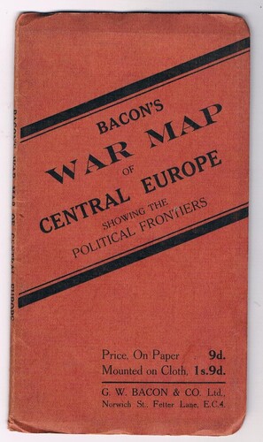
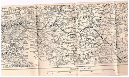
| Title | Bacon's War Map of Central Europe: Showing the Political Frontiers. |
|---|---|
| Publisher | London G. W. Bacon & Co. |
| Date | c. 1940 |
| Book ID | 38580 |
| First Edition |
Description
Printed paper wrappers, 10cm x 18 cm folded. Paper map Scale of Miles (61.3=1).
In very good condition.
Probably published in 1940 (?) but showing national boundaries as immediately prior to the German invasion of Poland in 1939.
Price:
£20.00